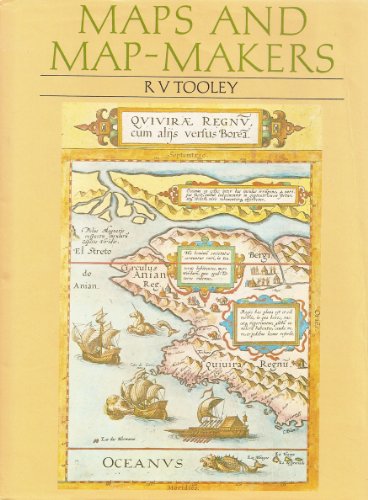
Maps and Map-Makers

sku: COM9780880291613USED
ACCORDING TO OUR RECORDS THIS PRODUCT IS NOT AVAILABLE NOW
$6.43
Shipping from: Canada
Description
4to. xv, 140 pp, preface, note to the 6th Edition, list of 104 b&w illustrations, list of 8 color plates, acknowledgments, general works of reference, introduction, I. Pre-Christian Geography to Ptolemy; II. Arabs and Medieval Europe; III. Italy; IV. Germany, Austria, and Switzerland; V. Holland and Belgium; VI. French Cartography; VII. English Map-Makers; English Marine Atlases; VIII. The County Maps of England and Wales; a. Large-Scale County Maps of England; b. English County Atlases; IX. Scotland and Ireland; X. Africa; XI. Asia; XII. America; XIII. Australia; Scandinavia, index with color and b&w maps throughout. Seventh Edition, 1987. Brown cloth with gilt lettering to spine. "A considerable literature has grown up in recent years on the subject of Cartography, but by far the greater part of this output is highly specialized, and for the most part scattered in the publications of various learned societies not often obtainable by the student or collector, or in limited and expensive monographs. It is to fill this desideratum that this book has been compiled, the aim being to give information and illustrations of the principal map-makers and their work from the earliest times to the nineteenth century, combining an appreciation of the popular decorative side of early maps with historical and bibliographical notes." from the Preface.
Price history chart & currency exchange rate
Customers also viewed

$68.59
Gedivoen Модельер женское платье Летнее платье с v-образным вырезом и коротким рукавом Шикарное кружевное ажурное однотонное длинное платье
aliexpress.ru
$1.50
Имитация мыши, фигурки животных, игрушки, Реалистичная мышь, статуя, коллекция декора для дома и сада-черная белая модель
aliexpress.ru
$3.97
Открытый кемпинг портативная палатка сумка для ногтей комплект мешок для хранения мешочек для молотка Органайзер
aliexpress.ru

$264.60
Подушка из бутадиен-стирольного каучука 12 линейные направительные рельсы; 6 штук в упаковке; Ночное белье из бутадиен-стирольного каучука 12 - 300/700/1100 мм + комплект шариковых винтов RM1204 SFU1204 - 350/750/1150 мм + BK/BF10 ЧПУ Запчасти
aliexpress.ru

$12.96
Женское сексуальное платье на тонких бретелях, с открытой спиной, в стиле пэчворк, летнее женское Плиссированное модное пляжное платье миди...
aliexpress.ru
$9.38
Женское платье-рубашка Sagace в горошек, с длинным рукавом, на пуговицах, с леопардовым принтом, длинная юбка, летняя одежда 2021
aliexpress.ru

$2.00
Новинка, плетеные заколки для волос для девочек, детские корейские заколки для волос с цветами и жемчугом в стиле принцессы, детские головные уборы, аксессуары для волос
aliexpress.ru
$8.03
Корейские шикарные носки-карго, милая девушка на шнурке, японская длинная грелка для ног, однотонная белая фотография, Женская фотообложка 2023
aliexpress.ru


$58.41
MNIXUAN Classics rome sandals boots 2019 summer new suede open toe knee high boots women flat sandals shoes casual shoes black
aliexpress.com
$10.48
FLUID Women Pack Of 2 Embellished Bracelet Style Straps Analogue Watch FL2-023-SL01-CP01, Silver
myntra.com
$81.58
mini earphone bag fashion women's one shoulder messenger small square bag leisure contrast check bag
fordeal.com
$21.08
eric emanuel designer mens shorts ee basic short men womens designers mesh breathable beach pants sports series basketball pant size, White;black
dhgate.com
$58.19
pants fake two pieces baggy pants joggers men loose trousers 2021 autumn hip hop streetwear cargo pant black wb288
dhgate.com

$42.47
designer perfume for women men spray parfum delina la rosee spray 75ml royal essence female unseix cologne long lasting time smell high frag
dhgate.com

$62.15
Curly Lace Front Human Hair Wigs Transparent Lace Frontal 4x4 Closure Wig 32 30 Inch Wig For Women Natural Hair Wigs PrePlucked
aliexpress.com

$9.96
Hot 1200Mbps USB Wireless Wifi Adapter 2.4GHz 5.8GHz Wireless-AC Network Card PC Wifi Receiver for MAC/Liunx OS/Windows7/8
aliexpress.com
)")


$7.80
Усовершенствованная и элегантная петля для волос из искусственного шелка, минималистичный кожаный ремешок с высоким хвостом 6pcs
joom.com
$16.98
Натуральний опал Дандарте, срібний кулон зі срібла 925 проби - Дизайн ручної роботи, Ювелірна прикраса для повсякденного носіння, Унікальний кулон, Подарунок на День матері 2.16 білий
joom.com

$30.66
5GU34DX9AB переключатель стеклоподъемника слева для Dodge Ram 1500 2500 3500 DAKOTA 02-10
aliexpress.ru
$18.00
1920*1080P AHD 180 градусов автомобильная передняя камера «рыбий глаз» для Subaru Forester 2019, передняя решетка с положительным обзором, камера HD 720P CVBS
aliexpress.ru
